
Peabody ZIP Directory Coverage
Official USPS materials and Massachusetts data identify two ZIPs for Peabody: 01960 and 01961. The first is the primary Peabody delivery code in the research, while the second is grouped with it in USPS sortation and state data. The available sources do not map neighborhoods or publish a complete delivery footprint for either one. That limitation matters. A postal label can narrow an address search, but it cannot establish which side of a municipal line a parcel occupies.
| ZIP | Areas Covered | Post Office | Notes |
|---|---|---|---|
| 01960 | Peabody city delivery in the reviewed USPS evidence | USPS Peabody facility result, 4 Essex Center Drive | Primary Peabody ZIP; exact address verification can return ZIP+4 |
| 01961 | Peabody ZIP grouped with 01960 in USPS sortation and state datasets | No separate facility identified in the reviewed materials | Small or limited-use presence; confirm its delivery type with USPS |
This postal grouping should therefore be used as a narrowing tool. It is not evidence that 01961 is exclusively a post-office-box code or a unique institutional code, because the research did not verify either designation. No official Peabody ZIP boundary map or split date was located. Check a particular delivery address with USPS before assigning it to a record trail.
Peabody ZIP 01961
01961 needs more care than the primary code. The reviewed USPS labeling material groups 01960-01961 under Peabody, Massachusetts 01960 for sortation, and a Massachusetts state dataset lists both with Peabody. Those facts support using 01961 as a Peabody search term. They do not reveal whether every address can receive it, whether it has a special delivery role, or where its delivery routes end. Treat those missing details as an address-verification question, not as a reason to guess.
For local search terms, names such as Peabody Square, South Peabody, West Peabody, Proctor, Brooksby, and the Washington Street historic area can be helpful descriptive variants. They are not official postal boundaries. The current custodian for an address question remains the relevant city, USPS, assessor, or Registry record. A neighborhood nickname should never replace the street number and municipality on a request.
Verify Peabody ZIP Delivery
USPS is the source for testing the delivery form of one address. The reviewed USPS Peabody facility result is at 4 Essex Center Drive, Peabody, MA 01960-9998. That result documents the facility and its extended code. It does not replace an address-specific postal verification for mail sent to a different delivery route.
The USPS facility result for Peabody is the source captured for the postal reference shown here.
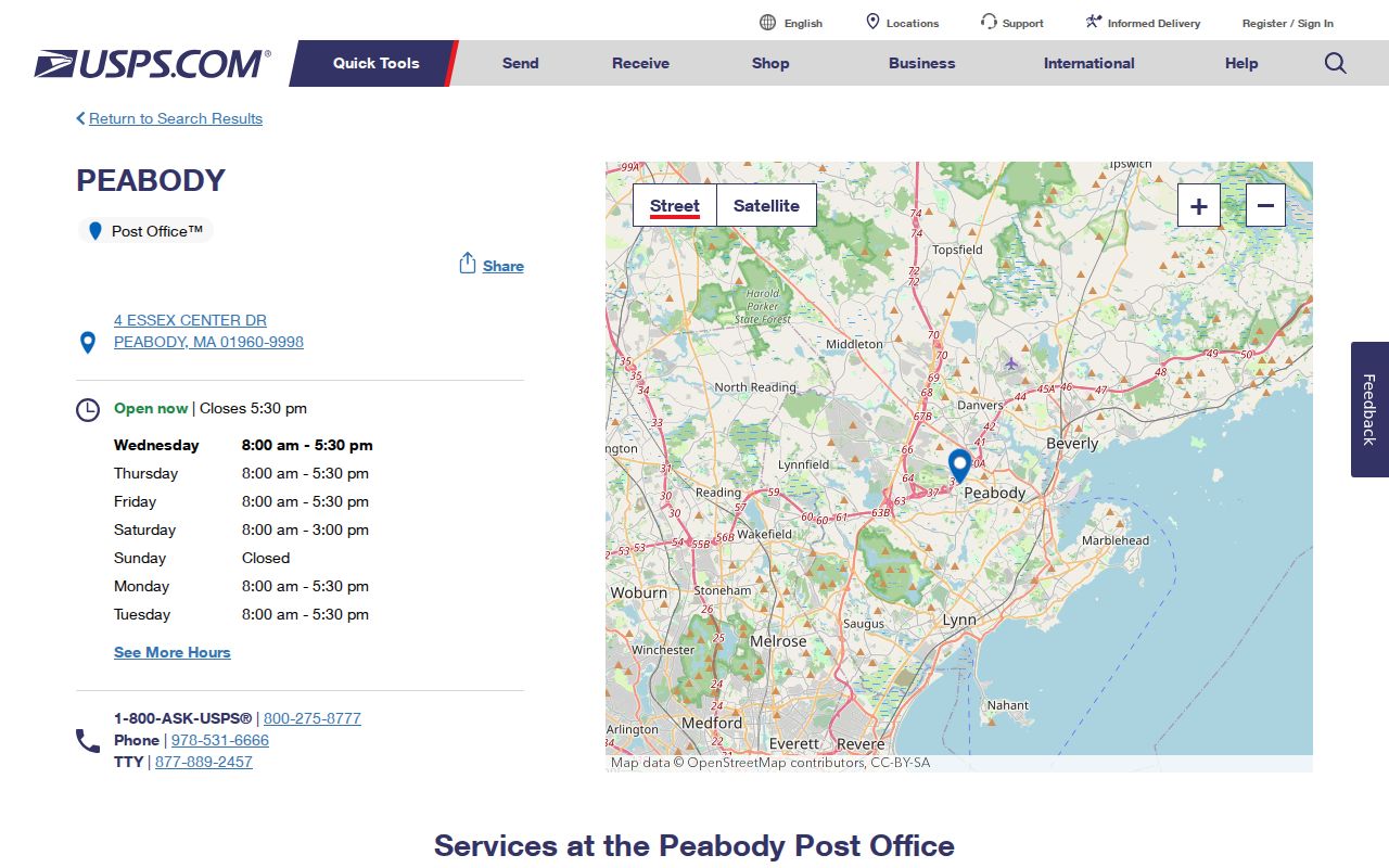
Use the facility record as a local reference, then verify the delivery code for the exact address before comparing it with municipal or parcel records.
The USPS ZIP basics guidance also explains why a specific address, rather than a city name alone, is the appropriate input for postal verification.
Peabody ZIP Status Fields
The Massachusetts voter-status form uses a five-digit residential postal code as one part of an individual’s own status check. It is not a Peabody name search or a public list of all voters in a ZIP. The state says the tool is for the individual voter, and the central voter registry’s names and addresses are not a general public record under M.G.L. c. 51, §47C. A person seeking their own result needs the registered name, full date of birth, ZIP, and the required acknowledgement.
| Field | Type | Required | Use or format |
|---|---|---|---|
| First Name | Text | Yes | Registered name, which may differ from a nickname |
| Last Name | Text | Yes | Registered surname |
| Month, Day, Year | Dropdowns | Yes | Full date of birth |
| ZIP | Text | Yes | Five-digit residential postal code |
| Individual-use agreement | Acknowledgement | Yes | Required before submitting the individual status check |
The Massachusetts voter-status tool is the official online route. State search tips say a recent mover can try the prior ZIP, and a recent registration may take two to three weeks to appear. When it fails, contact the local elections office rather than treating a non-match as proof that someone is not registered.
Find Residents Within Peabody ZIP
Start with a delivery-confirmed address or a person’s own verified postal code. Then use the source that answers the next question. The voter tool can only check an individual’s own status. The parcel layer can surface an owner mailing ZIP, which is not a directory of people at every physical address. Essex South Registry address search uses town, street, date, and document-type fields rather than a postal-code filter. Once the area is narrowed, the record trail changes from postal geography to street and parcel identifiers.
- Verify the exact delivery address through USPS and retain the five-digit result with the street address.
- For an individual checking their own registration status, use the state form with the registered name, full date of birth, ZIP, and acknowledgement.
- For a property question, locate the physical parcel on Peabody MapGeo and distinguish its mapped situs from the owner’s mailing information.
- Use the confirmed street and Peabody town setting in the Registry’s address search when a deed or recorded document is the next source.
- Compare dates and identifiers across the sources before drawing a conclusion about a person or address.
For a full address-by-address record chain after the postal area is known, use the Peabody street directory workflow.
Peabody Parcel ZIP Fields
The Peabody MapGeo viewer provides a Property Quick Search, map navigation, parcel clicks, and a city data disclaimer. Its supporting ArcGIS parcel layer is clearer about the available public attributes. The layer is named Peabody_Parcel and has owner, mailing-address, city, ZIP, map/parcel, and geometry fields. MapGeo reports FY2026 property data updated in January 2026, while the supporting layer shows an April 5, 2024 attribute edit date. Those dates describe data updates, not a guarantee that an address or owner record is complete.
| OWNER1 / OWNER | Owner name stored as a parcel attribute. |
|---|---|
| OWN_ADDR / ADDRESS | Owner mailing-address field, not necessarily the physical parcel address. |
| OWN_CITY / CITY | City associated with the owner mailing address. |
| OWN_ZIP / ZIP_CODE | Owner mailing ZIP, useful as a locator clue but not proof of occupancy. |
| MAP_PAR_ID | Assessor map and parcel identifier for matching records. |
| Geometry | Parcel polygon and measurements used to locate the mapped situs. |
The Peabody ArcGIS parcel layer is the source for those field names. A ZIP-wide query there can return owner mailing codes from elsewhere, so it cannot substitute for a map-based check of which parcels lie inside a postal delivery area.
Peabody ZIP and City Limits
USPS delivery geography and Peabody municipal geography do not match by definition. A record bearing 01960 or 01961 may be tied to a Peabody postal facility or route, while the parcel’s municipal placement still needs confirmation on a map or with the assessor. The reverse can also occur near a city line, where a parcel may use a neighboring postal city. Census ZCTAs are generalized statistical representations of postal geography, so they should not be treated as postal delivery maps or city-limit maps.
- ZIP and ZIP+4
- The five-digit code groups a delivery area; ZIP+4 adds four digits that refine a delivery segment for a specific address.
- PO-box ZIP
- A postal code used for post-office boxes. The research did not verify that designation for 01961.
- Unique ZIP
- A code assigned for one organization or large recipient. The research did not verify one for Peabody.
- Carrier route
- A USPS delivery route within a postal area. It is not a city ward, a parcel boundary, or a census boundary.
- Situs
- The physical location of the parcel, used as the anchor for mapped property and address records.
Peabody ZIP History
Postal geography is modern, while older records follow Peabody’s earlier municipal names. The area was tied to Salem’s Northfields, Farms, and Brooksby, then Danvers. South Danvers separated and incorporated in 1855, became Peabody in 1868, and was incorporated as a city in 1916. A historical deed, directory, church paper, or newspaper item may therefore use Salem, Danvers, or South Danvers. A modern ZIP cannot be pushed backward as the controlling search term for those older sources.
Use today’s ZIP to confirm a current address, then search historical names and a street or parcel description in older records. No verified Peabody street-renumbering or postal realignment schedule was located. Compare historic maps, directory titles, Registry plans, and assessor material before deciding that two differently named places are the same location.
Peabody ZIP Source Choices
Each source answers a narrower question than a general postal search. USPS verifies delivery coding for a particular address. The individual voter form verifies a person’s own registration status when its required fields are supplied. MapGeo and the ArcGIS layer help locate a parcel and identify an owner mailing field. The Essex South Registry connects a known Peabody street to recorded land documents through town and street search fields. None of these records alone establishes every current occupant at an address.
Keep the delivery result, street spelling, parcel ID, document date, and source URL together. That simple record trail makes it easier to resolve a near-city-line address or an owner mailing code that differs from the mapped parcel. It also avoids treating a postal shortcut as a complete resident list.
Note: When an official source has no documented ZIP-wide search, verify one address at a time rather than assuming a complete ZIP result exists.